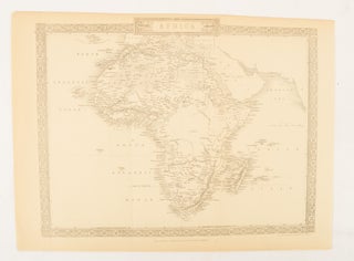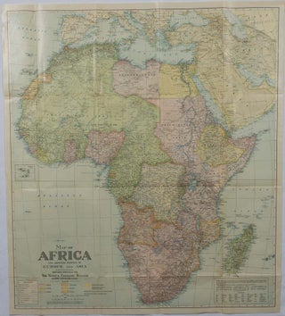
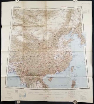
Map of Africa and adjoining portions of Europe and Asia.
Washington, D.C. National Geographic Society. 1922. Large folding printed colour map, 77.2 x 69.4 cm, small inset map of Cape Verde Island, note to the transliteration of place-names, reference key to railways, caravan routes as well as river systems, waterways and deserts, legend to Colonial or territorial control, original folds..... More
![Stock ID #214269 絵入鳥瞰東亜現勢地図. [Eiri Chokan Toa Gensei Chizu] [Illustrated...](https://asiabookroom.cdn.bibliopolis.com/pictures/214269.jpg?width=320&height=427&fit=bounds&auto=webp&v=1699570947)
![Stock ID #177140 最新世界大地図. [Saishin sekai daichizu]. [The Newest Map of the...](https://asiabookroom.cdn.bibliopolis.com/pictures/177140.jpg?width=320&height=427&fit=bounds&auto=webp&v=1708478205)
![Stock ID #215556 上海地圖 交通最新路綫. [Shanghai ditu Jiaotong zui xin luxian]....](https://asiabookroom.cdn.bibliopolis.com/pictures/215556.jpg?width=320&height=427&fit=bounds&auto=webp&v=1710493344)
![Stock ID #177068 Africa [and] N. W. Africa, Morocco, Algeria & Tunis. AFRICA - MAP, GEORGE F. CRAM](https://asiabookroom.cdn.bibliopolis.com/pictures/177068.jpg?width=320&height=427&fit=bounds&auto=webp&v=1697781802)