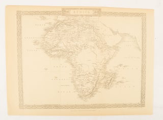
Africa.
London. The London Printing and Publishing Company. [Circa 1880s]. Printed map, 24 x 32.1 cm, decorative border, two original vertical folds, paper toned, mainly at the edges, inner margin of the sheet ragged, but in good order. A late edition of the map used for the well-known Tallis map, this..... More