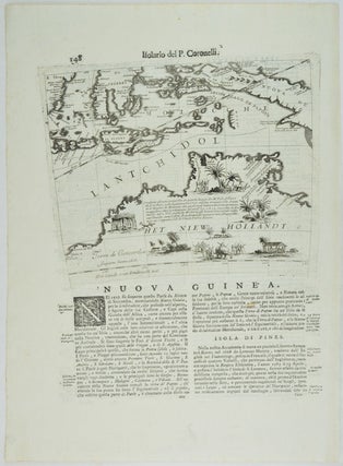
Nuova Guinea. Het Niew Hollandt. [Map of Northern Australia, Borneo, Indonesia and New Guinea].
(Circa 1697). Black and white map, ornate initial letter and double columns of text in Italian below and on the reverse. Sheet size 49.2 x 35cm, map size 24.5 x 27.4/30cm. The map was first published in 1688 as a gore sheet, a map with curved edges, which together with..... More