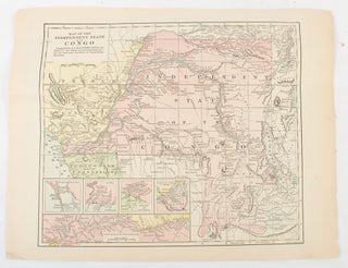
Map of the Independent State of the Congo.
New York. (Hunt & Eaton). (Circa 1893). Printed colour map, 24 x 28 cm, four thumbnail inset maps: Banana; Boma; Matadi & Environs; Stanley Pool (named for the explorer); and below, a lozenge inset of the road from Matadi to Leopoldville, marginal toning and small edge tears, one corner creased..... More