![Stock ID #154031 銅鐫 大日本國細圖 西国之部 下. [Dōsen Dainihonkoku saizu saigoku-no-bu ge]. [Copperplate Printed Detailed map of Great Japan: Section of Western Japan Part 2]. 村上勘兵衛, 須原屋茂兵衛, 河内屋喜兵衛 ET, KYOTO, EDO, OSAKA, MURAKAMI KANBEI, SUHARAYA MOHEI, KAWACHIYA KIHEI.](https://asiabookroom.cdn.bibliopolis.com/pictures/154031.jpg?width=768&height=1000&fit=bounds&auto=webp&v=1706165208)
![銅鐫 大日本國細圖 西国之部 下. [Dōsen Dainihonkoku saizu saigoku-no-bu ge]. [Copperplate Printed Detailed map of Great Japan: Section of Western Japan Part 2].](https://asiabookroom.cdn.bibliopolis.com/pictures/154031_2.jpg?auto=webp&v=1706165208)
![銅鐫 大日本國細圖 西国之部 下. [Dōsen Dainihonkoku saizu saigoku-no-bu ge]. [Copperplate Printed Detailed map of Great Japan: Section of Western Japan Part 2].](https://asiabookroom.cdn.bibliopolis.com/pictures/154031_3.jpg?auto=webp&v=1706165208)
![銅鐫 大日本國細圖 西国之部 下. [Dōsen Dainihonkoku saizu saigoku-no-bu ge]. [Copperplate Printed Detailed map of Great Japan: Section of Western Japan Part 2].](https://asiabookroom.cdn.bibliopolis.com/pictures/154031_4.jpg?auto=webp&v=1706165208)
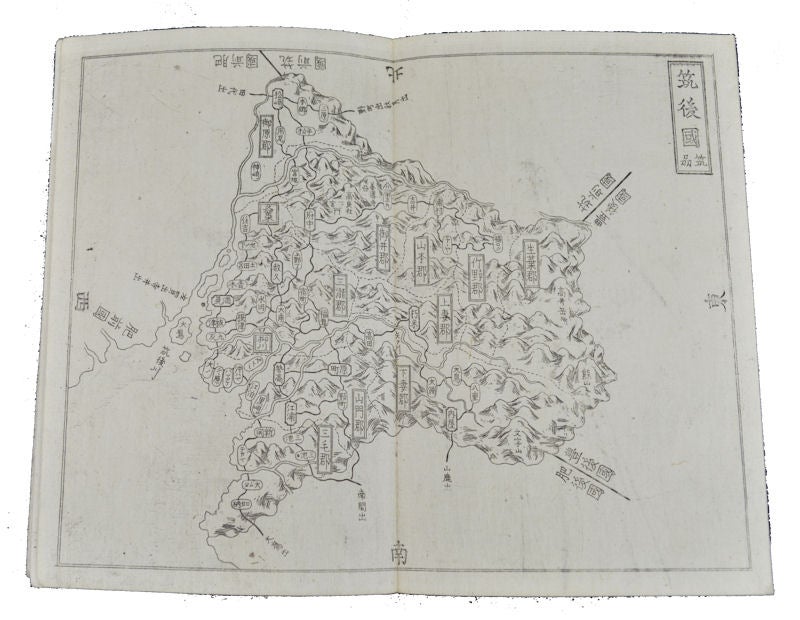
銅鐫 大日本國細圖 西国之部 下. [Dōsen Dainihonkoku saizu saigoku-no-bu ge].
[Copperplate Printed Detailed map of Great Japan: Section of Western Japan Part 2].
Kyoto, Edo, Osaka, Ise, and Nagoya. 元治2. [ 1865]. Stock ID #154031 This atlas shows the provinces in the western part of Honshu Island and those of Shikoku and Kyushu Islands, including Okinawa Islands. Each delicate black and white map shows towns, traffic routes, and rough geographic features of mountains. When referring to this item please quote stockid 154031.
Part 2 only. 4pp of text in Japanese, 34 double page copper engraved maps showing the provinces of western Japan, accordion style binding. 16.5 x 11cm. A little insect damage lower cover, last six leaves of text and final map causing loss to some characters though the text it is still legible, some very minor spotting or soiling, but generally very good.
Price: $350.00 AU