![Stock ID #155215 標準大東亞分圖・南洋群島 (内南洋). [Hyojun Daito-A bunzu: Nanyo gunto (nai Nanyo)]. [Standard Sectional Map of the Greater East Asia: the South Sea Islands (Inner South Sea)]. SERIZAWA KEIGO, 芹澤馨吾.](https://asiabookroom.cdn.bibliopolis.com/pictures/155215.jpg?width=768&height=1000&fit=bounds&auto=webp&v=1712195898)
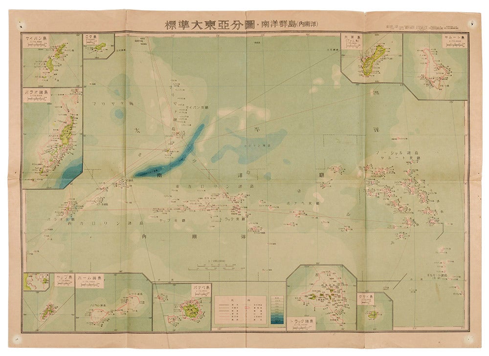
標準大東亞分圖・南洋群島 (内南洋). [Hyojun Daito-A bunzu: Nanyo gunto (nai Nanyo)].
[Standard Sectional Map of the Greater East Asia: the South Sea Islands (Inner South Sea)].
統正社 [Tōseisha ]. Showa 18 [ 1943]. Stock ID #155215 This Japanese map of Micronesia shows the Mariana Islands, Eastern and Western Caroline Islands, Marshall Islands, and Gilbert Islands. The separate maps around the edge are [clockwise from the upper right corner]: Jaluit Atoll, Guam Island, Rota Island, Saipan Island, Palau Islands, Yap Island, Hall Islands, Pohnpei Island, Truk Islands, and Kusaie Island. When referring to this item please quote stockid 155215.
Colour folded map, 54. x 76.5cm. Pinholes at corners, light even browning, good copy.
Price: $325.00 AU
See all items in
All Galleries,
Ephemera and Maps
See all items by SERIZAWA KEIGO, 芹澤馨吾