![Stock ID #163274 上海市交通图. [Shanghai shi jiao tong tu]. [Transportation Map of Shanghai]. SHANGHAI URBAN CONSTRUCTION BUREAU SURVEY CORPS, 上海市城市建设局测量总队.](https://asiabookroom.cdn.bibliopolis.com/pictures/163274.jpg?width=768&height=1000&fit=bounds&auto=webp&v=1697764645)
![上海市交通图. [Shanghai shi jiao tong tu]. [Transportation Map of Shanghai].](https://asiabookroom.cdn.bibliopolis.com/pictures/163274_2.jpg?auto=webp&v=1697764636)
![上海市交通图. [Shanghai shi jiao tong tu]. [Transportation Map of Shanghai].](https://asiabookroom.cdn.bibliopolis.com/pictures/163274_3.jpg?auto=webp&v=1697764636)
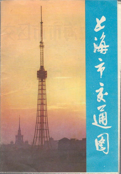
上海市交通图. [Shanghai shi jiao tong tu].
[Transportation Map of Shanghai].
上海. [Shanghai]. 上海人民出版社.[Shanghai ren min chu ban she]. 1976. 2nd Edition, 1st Printing. Stock ID #163274 "Transportation Map of Shanghai Urban Area": no scale given, legend left lower corner showing routes of railways, buses/trolleybuses, regional coaches, and ferries. Landmark buildings illustrated on the map, including Shanghai Stadium, Shanghai Television Headquarter, Industrial Exhibition Hall, Site of the First National Congress of the Chinese Communist Party, established residential apartments, and more. A table of terminuses for trolleybuses and buses listed lower right section. When referring to this item please quote stockid 163274.
Folding single sheet printed on both sides. The two maps are: a large comprehensive map "Transportation Map of Shanghai Urban Area" and a slightly smaller map: "Transportation Map of Shanghai Rural Area", folded as issued, in colour. Sheet measures 38 x 52.2cm. Trifle creased along folds, very good.
On reverse, it includes a map of "Transportation Map of Shanghai Rural Area" and more general information on public transport and services (hotel, hospital, tickets, banks, department stores, etc.). The rural Shanghai map covers areas of Jiading, Baoshan, Qingpu, Songjia, Fengxian, Nanhui, Congming, Chuansha. With the rapid city's expansion, the areas have become part of Shanghai urban area.
Price: $40.00 AU