![Stock ID #171452 中支方面日支両軍態勢要図. [Chushi homen Nisshi ryogun taisei yozu]. [Positioning Map of the Japanese and Chinese Forces in Central China]. TEIKOKU ZAIKYO GUNJINKAI HONBU, 帝国在京軍人会本部編.](https://asiabookroom.cdn.bibliopolis.com/pictures/171452.jpg?width=768&height=1000&fit=bounds&auto=webp&v=1697772722)
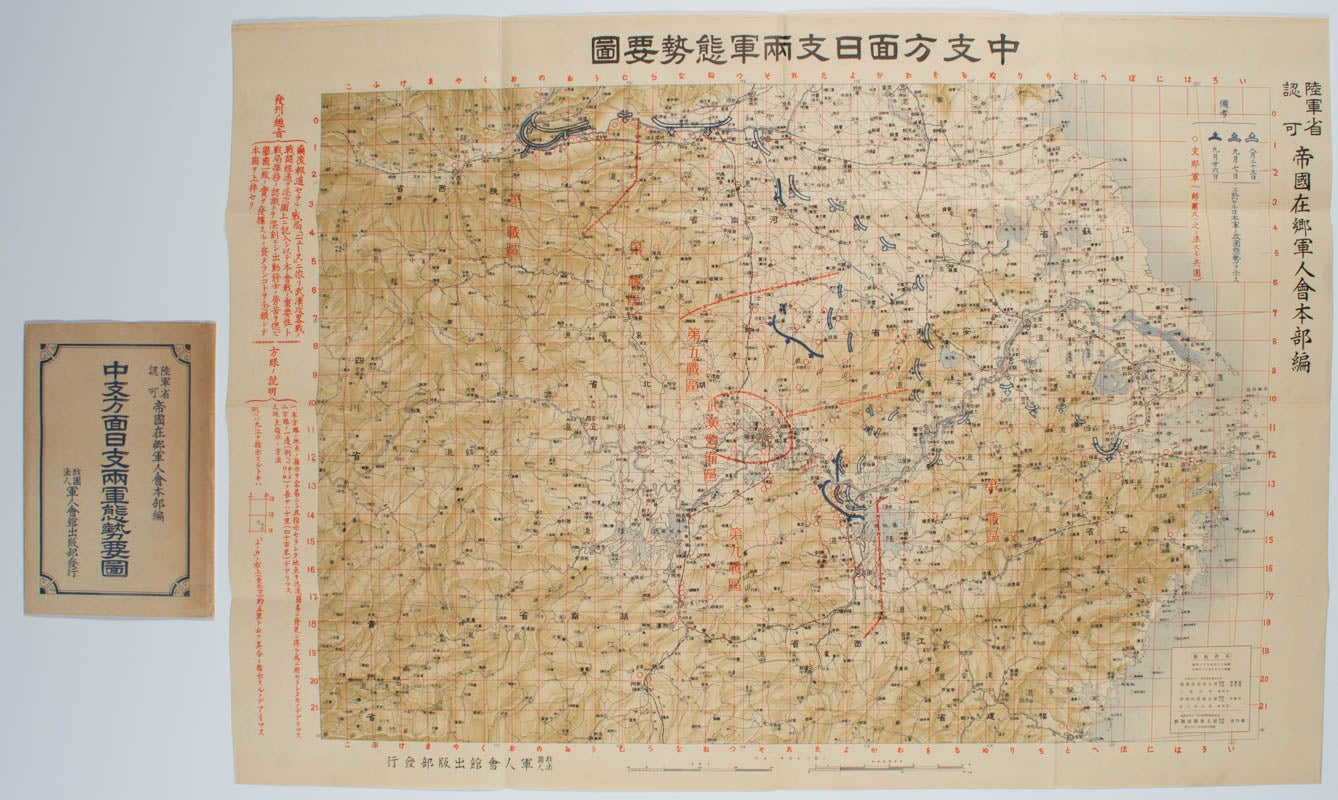
中支方面日支両軍態勢要図. [Chushi homen Nisshi ryogun taisei yozu].
[Positioning Map of the Japanese and Chinese Forces in Central China].
東京. [Tokyo]. 軍人会出版部. [Gunjinkai Shuppanbu]. 昭和 13 [ 1938]. Stock ID #171452 This map shows the eastern China region along the Yangtze and around Wuhan where the Japanese troops attacked in 1938. The map shows positionings of the Japanese troops on 23 August, 7 September and 26 September 1938 and defence positions of the Chinese troops. When referring to this item please quote stockid 171452.
Coloured folding map, scale 1: 2.3 million, with original paper wrapper, very good copy. Map measures: 53.3 x 76.3cm; wrapper: 20.5 x 14.1cm.
The map was published by the Ex-Servicemen's Association with an approval of the Ministry of Army. The Association's aim in publishing the map are: To follow the fighting as it developed; to reflect on soldiers' hardship on the ground; to unite as a nation.
As the fighting in China developed, ex-servicemen were able to follow the advancement of the Japanese forces on the map. However, no doubt disappointingly to this audience, the fighting continued for years without a decisive victory to Japan as had been hoped for in the early years.
Price: $400.00 AU