
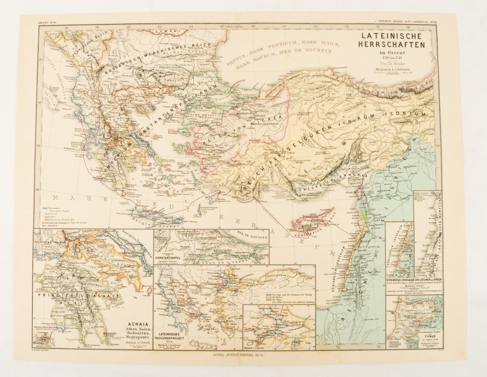
Lateinische Herrschaften im Orient 1210 bis 1311
Gotha: Justus Perthes, 1876. Stock ID #174910 A most handsome and highly detailed map detailing provinces of the Latin Empire in the wake of the Crusades. The inset maps depict Achaia in Greece, Divisions of the Empire, and a city plan of Constantinople, issued for the "Hand-Atlas für die Geschichte des Mittelatters und die Neueren Zeit" When referring to this item please quote stockid 174910.
Map with original colour and outline hand-colour, 32.2 x 40 cm, seven inset maps, text in German, central fold, slight marginal toning, in very good condition.
Price: $125.00 AU
See all items in
Antiquarian,
Ephemera and Maps
See all items by KARL AND MENKE SPRUNER, THEODOR