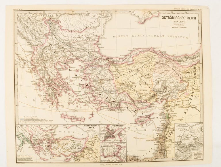
Oströmisches Reich 1096-1204
Gotha: Justus Perthes, 1876. Stock ID #174911 A most handsome and highly detailed map detailing the Eastern provinces of the Byzantine/Roman Empire before the Fourth Crusade. The inset maps depict Constantinople, Divisions of the Empire, and Antioch, issued for the "Hand-Atlas für die Geschichte des Mittelatters und die Neueren Zeit" When referring to this item please quote stockid 174911.
Map with original colour and outline hand-colour, 32.2 x 40 cm, text in German, four inset maps, central fold, slight marginal toning, and spotting on the verso, but in very good condition.
Price: $125.00 AU
See all items in
Antiquarian,
Ephemera and Maps