![Stock ID #175770 新東亜資源開発解説地図. [Shin Tōa shigen kaihatsu kaisetsu chizu]. [New East Asia Resource Development Interpretive Map]. TŌKYŌ NICHINICHI SHINBUNSHA, 東京日日新聞社.](https://asiabookroom.cdn.bibliopolis.com/pictures/175770.jpg?width=768&height=1000&fit=bounds&auto=webp&v=1699562905)
![新東亜資源開発解説地図. [Shin Tōa shigen kaihatsu kaisetsu chizu]. [New East Asia Resource Development Interpretive Map].](https://asiabookroom.cdn.bibliopolis.com/pictures/175770_2.jpg?auto=webp&v=1699562905)
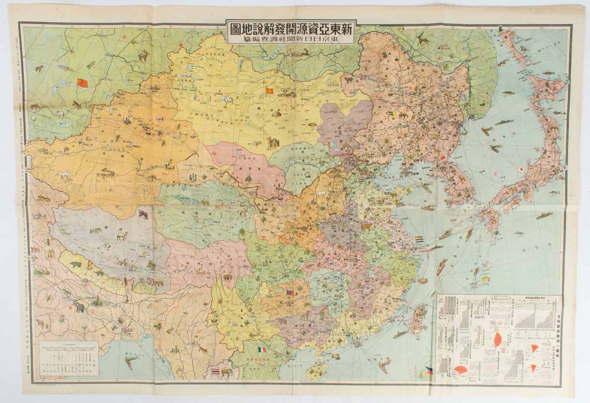
新東亜資源開発解説地図. [Shin Tōa shigen kaihatsu kaisetsu chizu].
[New East Asia Resource Development Interpretive Map].
東京. [Tokyo]. 東京日日新聞社. [Tōkyō Nichinichi Shinbunsha]. Showa 14 [ 1939]. Stock ID #175770 This map of China and surrounding areas is richly illustrated with pictographs showing the resources and products of the countries of East Asia together with their road, railway, sea and air routes which are marked in detail. The reverse side of the map provides summary information on China, each region, Manchukuo, and Outer Mongolia with black and white photographic illustrations. Chinese trade and resource graphs are printed on the corner of the map and include steel, petroleum, rice, pigments and dyes, wood products etc; comprehensive information on population, Chinese governments and Western investments are also included. When referring to this item please quote stockid 175770.
Colour folding illustrated map, charts, black and white photographic illustrations. 55 x 79cm. Tiny hole adjacent to one fold, a little light time toning, still a very attractive copy.
The map was issued in 1939 as a supplement to Volume 3, Number 1 issue of the Tonichi Jikyoku Joho (Tokyo Nichinichi Shinbun Current Affair and Information), which later became Mainichi Jikyoku Joho. The map and detailed information demonstrate the deep interest Japan had in China and its resources at this time strongly reflecting its territorial desires.
Price: $875.00 AU