![Stock ID #175919 [Map - Malay Peninsula] Karte von Hinter Indien. HERRMANN JULIUS MEYER.](https://asiabookroom.cdn.bibliopolis.com/pictures/175919.jpg?width=768&height=1000&fit=bounds&auto=webp&v=1713424691)
![[Map - Malay Peninsula] Karte von Hinter Indien](https://asiabookroom.cdn.bibliopolis.com/pictures/175919_2.jpg?auto=webp&v=1713424691)
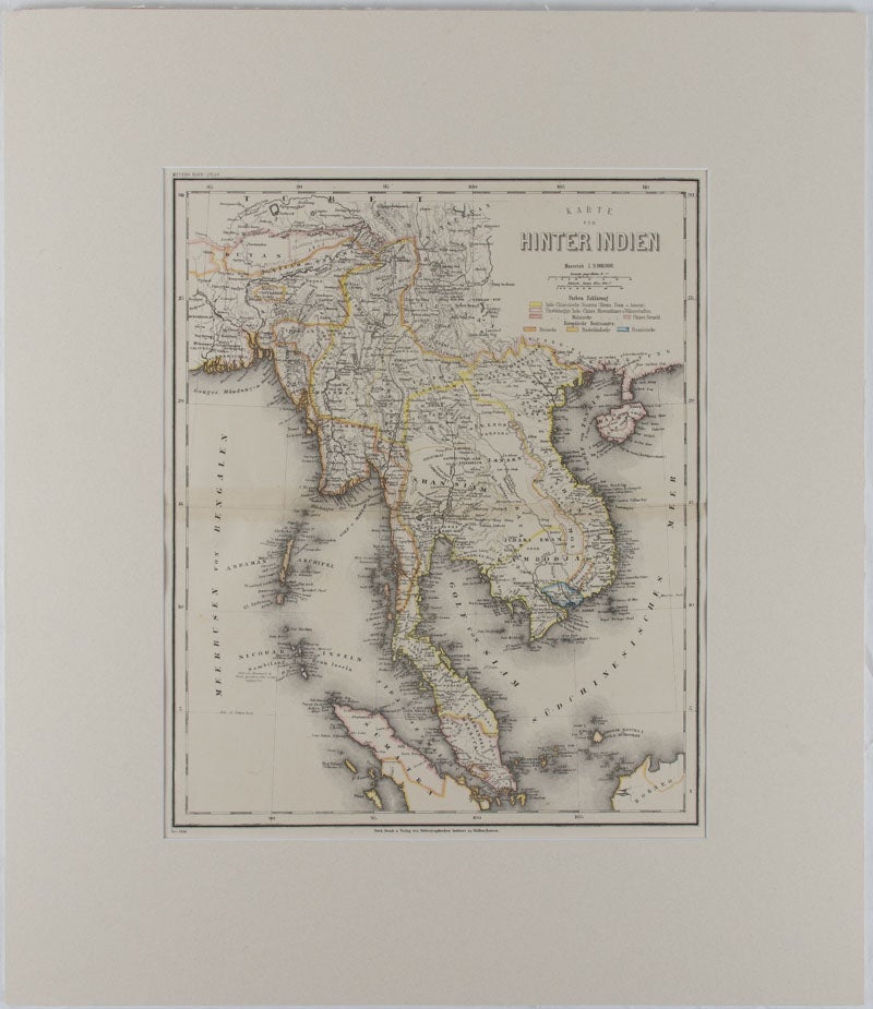
[Map - Malay Peninsula] Karte von Hinter Indien
Hildburghausen: Bibliographischen Instituts, 1866. Stock ID #175919 Detailed 19th Century regional map of the Malay Peninsula, Vietnam, Cambodia, etc. extending from the Straits of Malaca and Singapore north to Hainan and the Gulf of Tonquin. Text in German, prepared for Meyer's Hand Atlas (noted in the marginal caption top-left) When referring to this item please quote stockid 175919.
Engraved map with outline hand colour, central fold, 37 x 30 cm, 47.4 x 36.2 cm (sheet), colour key to territorial control and administrative boundaries, major cites, towns, roads, rivers and mountains, relief shown by hachures, light toning in very good condition, preserved in modern window mount.
Price: $350.00 AU