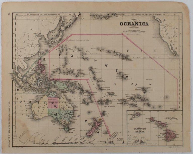
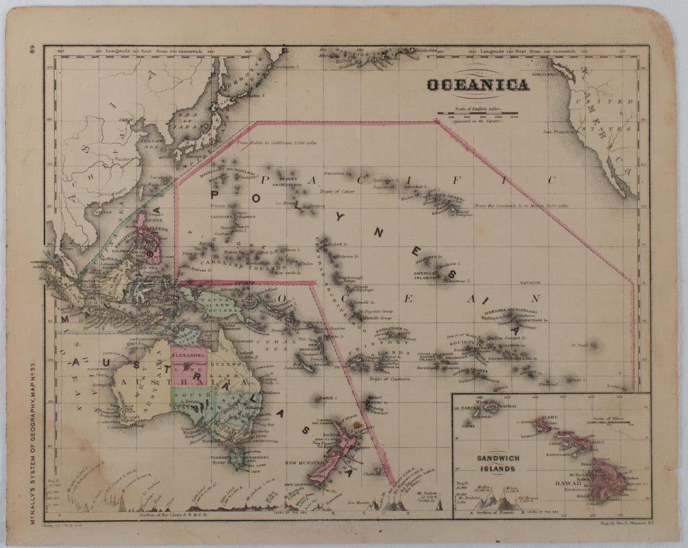
Oceanica.
[New York.]: McNally. [ 1866]. Stock ID #176013 Attractive coloured map of the Pacific.The Northern Territory is marked as North Australia and Alexandra Land and the South Island of New Zealand as Munster Land. The foot of the map features cross-section profiles through Southeast Asia, the north and east coast of Australia, Tasmania, the Islands of New Zealand and Hawaii. The Sandwich Islands, Hawaii, is shown in an inset map lower right corner. “Polynesia” is shown in a wide arc over the Pacific encompassing Polynesia and Micronesia; “Malaysia” in an arc stretching from Sumatra to just north of the Philippines, and “Australasia” across Australia and New Zealand. When referring to this item please quote stockid 176013.
Printed map with original handcolour, 21.4 x 27.3 cm, inset map of the Sandwich Islands, cross-section profiles showing mountain heights above sea level, edges of the map chipped and browned and the paper toned, tidemak to the lower left corner, prepared as map 33 for "McNally's System of Geography" with their text on the verso, in very good condition.
Price: $125.00 AU