![Stock ID #176104 支那見学大地図. [Shina kengaku daichizu]. [Large Sightseeing Map of China]. KEIZŌ SHIMADA, 島田啓三.](https://asiabookroom.cdn.bibliopolis.com/pictures/176104.jpg?width=768&height=1000&fit=bounds&auto=webp&v=1699562903)
![支那見学大地図. [Shina kengaku daichizu]. [Large Sightseeing Map of China].](https://asiabookroom.cdn.bibliopolis.com/pictures/176104_2.jpg?auto=webp&v=1699562903)
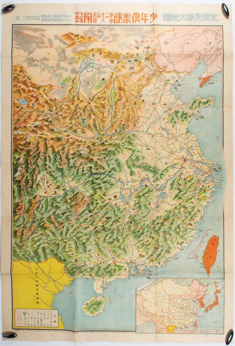
支那見学大地図. [Shina kengaku daichizu].
[Large Sightseeing Map of China].
大日本雄弁会講談社. [Dainihon Yūbenkai Kōdansha]. Showa 13 [ 1938]. Stock ID #176104 Published as a supplement to the young people's magazine Shonen Kurabu, this map provides a colourful overview of China, decorated with images of local people farming, herding animals, mining etc., and of farm animals, wildlife and major landmarks (including the Great Wall). The image of China seems oddly rural and devoid of images of urban buildings, and - although the Japanese invasion of China was in full swing when this map was published - the only indication of military action is the fact that the city of Nanjing is decorated with a figure waving the flag of the "The Reformed Government", the short-lived pro-Japanese regime established in the region by Liang Hongzhi and others in March 1938. When referring to this item please quote stockid 176104.
Large colour folding map of China, 96 x 66 cm. Few tears along folds, occasional spotting but otherwise a good copy of a striking pictorial map.
The map was designed by Shimada Keizo, the mid-twentieth centuryJapanese manga artist best known for his "Boken Dankichi" comic series. In stark conteast to this peaceful "sight-seers" depiction of China, the reverse of the map is decorated with a series small photos and drawings illustrating "A Picture Diary of the Shining Victories of the China Incident". These depict Japan's military incursion into China from the start of the 1937 "Marco Polo Bridge Incident" to the Japanese occupation of Xuzhou in May 1938.
Issued as a supplement of 少年倶楽部. [Shōnen Kurabu]. Volume 25, no. 8 published in 8 June Showa 13 [1938].
Price: $750.00 AU