![Stock ID #176167 標準大東亜分図2. 南洋群島(内南洋)篇. [Hyōjun Dai tōa bunzu 2. Nan'yō guntō (uchinan'yō)-hen]. [Standard Maps of the Greater East Asia 2: The Southsea Islands (Inner South Seas)]. SERIZAWA KEIGO, 芹沢馨吾.](https://asiabookroom.cdn.bibliopolis.com/pictures/176167.jpg?width=768&height=1000&fit=bounds&auto=webp&v=1709611282)
![標準大東亜分図2. 南洋群島(内南洋)篇. [Hyōjun Dai tōa bunzu 2. Nan'yō guntō (uchinan'yō)-hen]. [Standard Maps of the Greater East Asia 2: The Southsea Islands (Inner South Seas)].](https://asiabookroom.cdn.bibliopolis.com/pictures/176167_2.jpg?auto=webp&v=1709611282)
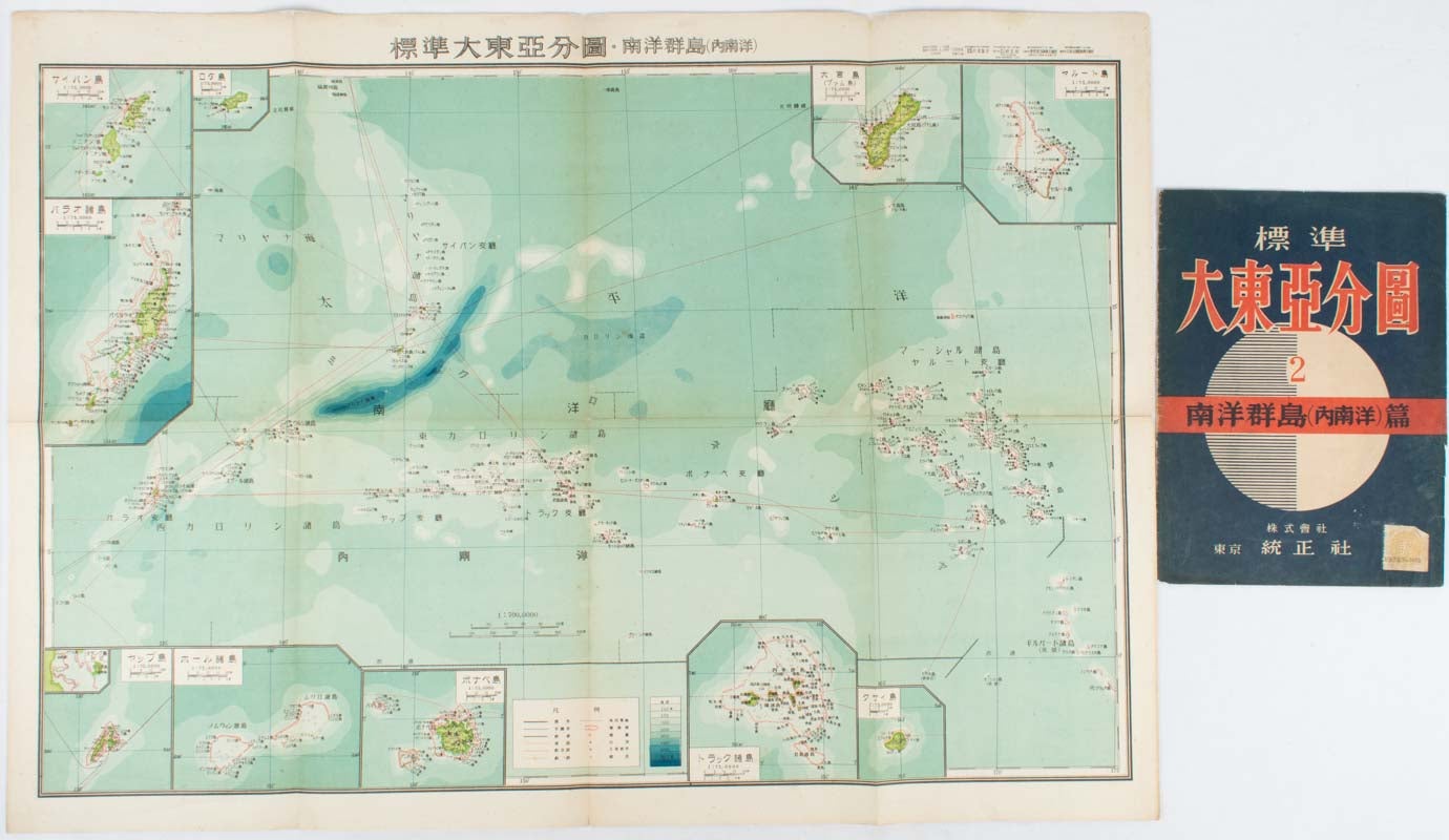
標準大東亜分図2. 南洋群島(内南洋)篇. [Hyōjun Dai tōa bunzu 2. Nan'yō guntō (uchinan'yō)-hen].
[Standard Maps of the Greater East Asia 2: The Southsea Islands (Inner South Seas)].
東京. [Tokyo]. 統制社. [Toseisha]. Showa 18 [ 1943]. Stock ID #176167 This 1943 map covers the Micronesian Islands which was under the Japanese responsibility under the League of Nation Mandated Territories, namely the Marianas, the Marshall Islands, and the Caroline Islands. Inset maps include Guam, Chuk, Saipan and Palau where military facilities were built before and during the Pacific War. When referring to this item please quote stockid 176167.
Folding colour map of the Marianas, the Marshall Islands, and the Caroline Islands. 54.5 x 76cm, large map with 10 inset maps of islands, large map scale 1:7000000, inset maps scales 1:75:000000, folded 27 x19cm. Original wrapper, small holes at centre of fold lines, now secured with archival washi, some light stains to the verso, a little light browning along folds, overall a good copy.
Price: $260.00 AU