![Stock ID #176175 標準大東亜分図20. インド東部篇. [Hyōjun Daitōa bunzu 20. Indo tōbu-hen]. Standard Maps of the Greater East Asia 20: East India. SERIZAWA KEIGO, 芹沢馨吾.](https://asiabookroom.cdn.bibliopolis.com/pictures/176175.jpg?width=768&height=1000&fit=bounds&auto=webp&v=1708478202)
![標準大東亜分図20. インド東部篇. [Hyōjun Daitōa bunzu 20. Indo tōbu-hen]. Standard Maps of the Greater East Asia 20: East India](https://asiabookroom.cdn.bibliopolis.com/pictures/176175_2.jpg?auto=webp&v=1708478202)
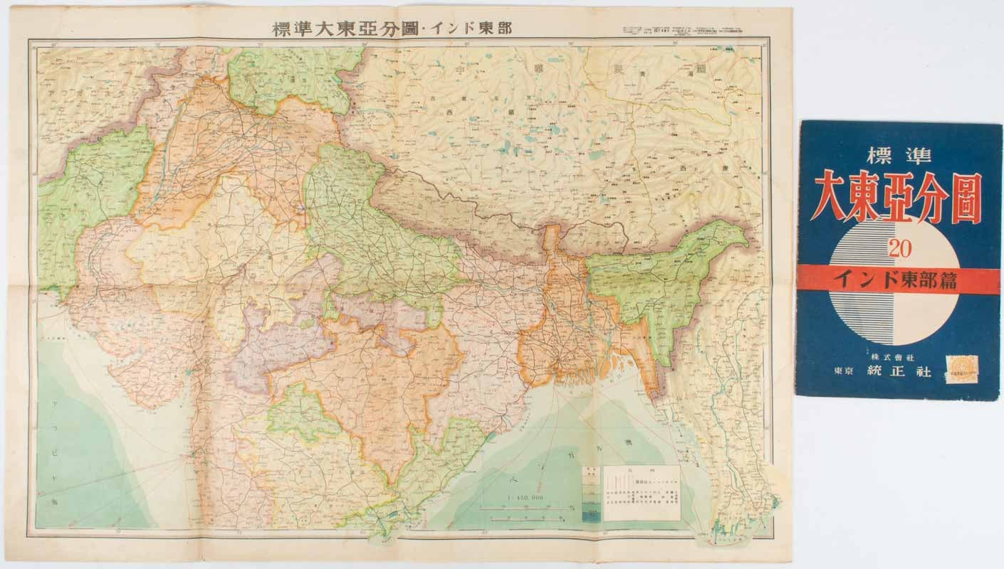
標準大東亜分図20. インド東部篇. [Hyōjun Daitōa bunzu 20. Indo tōbu-hen].
Standard Maps of the Greater East Asia 20: East India
東京. [Tokyo]. 統制社. [Toseisha]. Showa 18 [ 1943]. Stock ID #176175 Scale plan of the North of India with the countries surrounding, printed by Toseisha in 1943. The map legend shows infrastructure deemed important to the Land Survey Bureau of the General Staff Headquarters of the Imperial Japanese army, such as boundaries, powerlines, quarries and mines; railroads, sea-routes, etc. When referring to this item please quote stockid 176175.
Folding colour map of northern India and the Himalayan Region, 1:450000 scale, 76 x 54cm folds to 27.5 x 19.5cm in lightly worn original wrapper. Light staining margins in a few places, neat repairs at folds on reverse, otherwise very good copy.
Similar to other Japanese maps of this period, the territory of modern-day Arunachal Pradesh is shown as a part of the Chinese provinces of Xizang (Tibet) and Xikang, rather than British India.
Price: $250.00 AU