![Stock ID #176323 奈良市街全図. [Nara shigai zenzu]. [Complete Map of Nara City Area]. IHEI KUSAKA, 日下伊兵衛.](https://asiabookroom.cdn.bibliopolis.com/pictures/176323.jpg?width=768&height=1000&fit=bounds&auto=webp&v=1699563766)
![奈良市街全図. [Nara shigai zenzu]. [Complete Map of Nara City Area].](https://asiabookroom.cdn.bibliopolis.com/pictures/176323_2.jpg?auto=webp&v=1699563766)
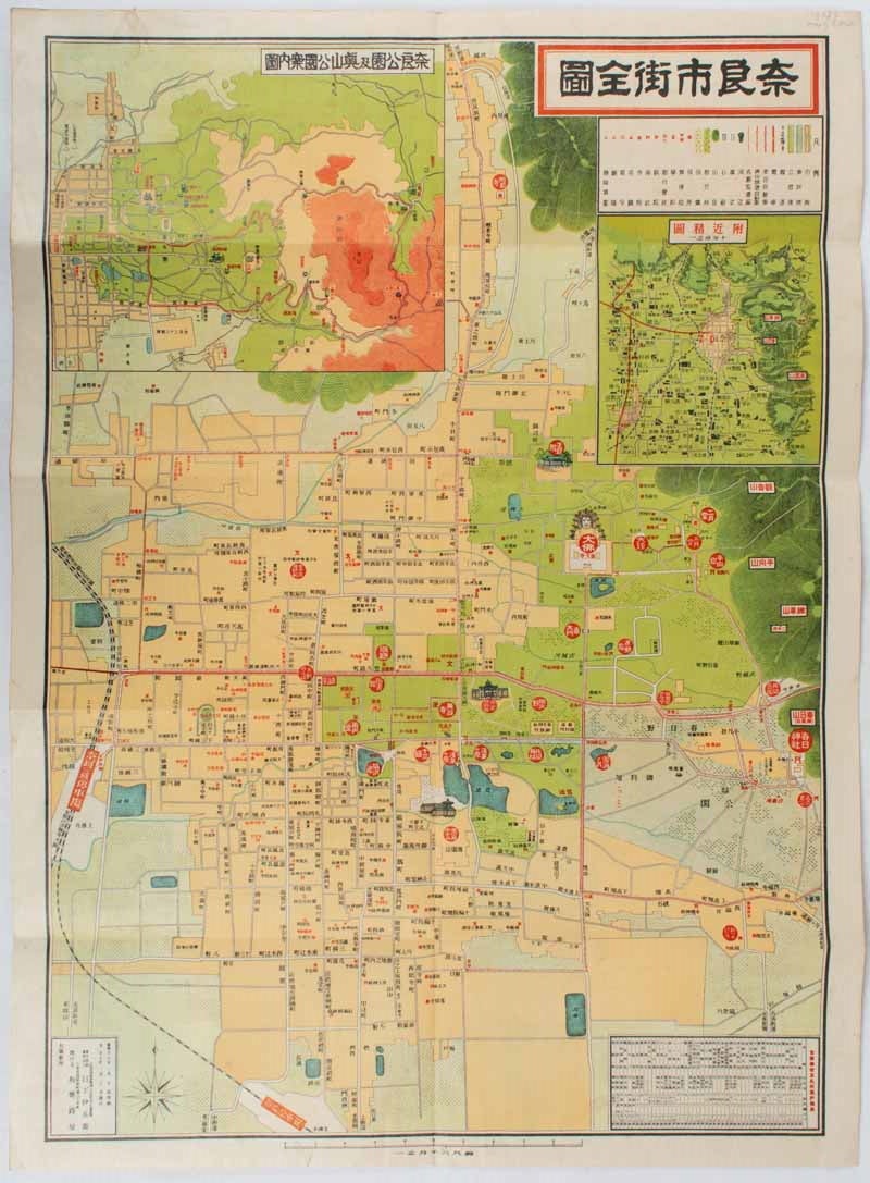
奈良市街全図. [Nara shigai zenzu].
[Complete Map of Nara City Area].
大阪. [Osaka]. 日下伊兵衛. [Kusaka, Ihei]. Showa 13 [ 1938]. Stock ID #176323 Late 1930s tourist map of Nara City showing the central part of the city with its parks and temples, includes a chart showing locations and distances of major sightseeing sites. When referring to this item please quote stockid 176323.
Folding colour map with two inset maps and a chart, scale 1:8,000, 54.5 x 39.7cm, black and white photographic illustrations and Japanese text on reverse. Light fairly even browning and a small stain on reverse of the map not visible on map. Map very good and bright.
One of the inset maps shows Nara and its region (scale 1:100,000); another shows a detailed map of Nara Park and Okuyama Park. On the reverse, tourist information for major sightseeing sites and temples is printed with black and white photographic illustrations.
Price: $250.00 AU