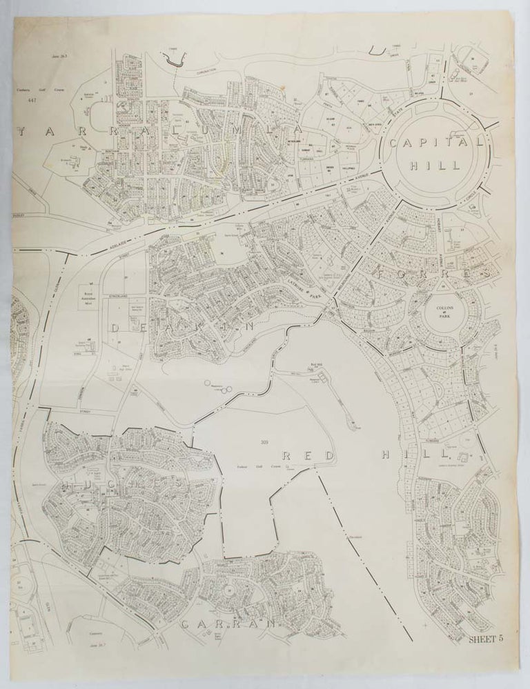
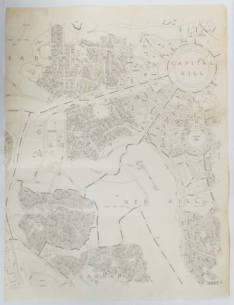
Map of Canberra's Inner South, showing Capitol Hill, Yarralumla, Deakin, Forrest, Hughes, Red Hill and Garran.
Canberra. No publisher. nd. (early 1970s). Stock ID #176618 When referring to this item please quote stockid 176618.
Black and white map of Canberra showing Capitol Hill, Yarralumla, Deakin, Forrest, Hughes, Red Hill and Garran with a few anomalies such the proposed road Gowrie Drive which is shown as crossing the edge of Red Hill from Kent Street in Deakin (beside the Deakin Telephone Exchange) to Strickland Crescent. A few small closed tears to edges now repaired, map measures approximately 75 x 58cm. Sheet 5.
Price: $200.00 AU
See all items in
Ephemera and Maps
See all items by 1970S UNTITLED GOVERNMENT MAP OF INNER SOUTH CANBERRA