![Stock ID #177089 日本見学地図. [Nihon kengaku chizu]. [Pictorial Atlas of Japan]. NAGAI TAKEO, 長井武雄.](https://asiabookroom.cdn.bibliopolis.com/pictures/177089.jpg?width=768&height=1000&fit=bounds&auto=webp&v=1697781805)
![日本見学地図. [Nihon kengaku chizu]. [Pictorial Atlas of Japan].](https://asiabookroom.cdn.bibliopolis.com/pictures/177089_2.jpg?auto=webp&v=1697781805)
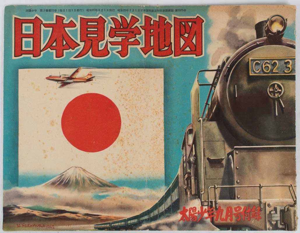
日本見学地図. [Nihon kengaku chizu].
[Pictorial Atlas of Japan].
妙義出版社. [Myōgi Shuppansha]. Showa 27 [ 1952]. Stock ID #177089 Colourful pictorial atlas was issued as a supplement to the boy's magazine, 太陽少年 [Taiyō Shōnen] on September 1952. The magazine ceased publication in the mid 1950s. When referring to this item please quote stockid 177089.
Seven colour pictorial maps in original pictorial oblong wrappers, 25.5 x 33cm, 16pp, atlas shows a mild vertical crease. Wrappers a trifle worn at edges and are foxed in places.
The delightful pictorial maps in this atlas cover Japan in seven sections from Hokkaido to Kyushu but do not include Okinawa which was under the control of the United States by that time. Each pictorial map shows the areas main cities, railway networks and main local produce in colour with inset illustrations of major sites. Text opposite each map give details of the geography, climate, main industries and produce of the regions shown and include some line illustrations. The text is very readable and made a good educational resource for young children.
Price: $650.00 AU