![Stock ID #177223 相模武蔵二州図. [Sagami Musashi nishu-zu]. [Map of Sagami and Musashi Provinces]. NAIMUSHO CHIRIKYOKU, 内務省地理局.](https://asiabookroom.cdn.bibliopolis.com/pictures/177223.jpg?width=768&height=1000&fit=bounds&auto=webp&v=1699563767)
![相模武蔵二州図. [Sagami Musashi nishu-zu]. [Map of Sagami and Musashi Provinces].](https://asiabookroom.cdn.bibliopolis.com/pictures/177223_2.jpg?auto=webp&v=1699563767)
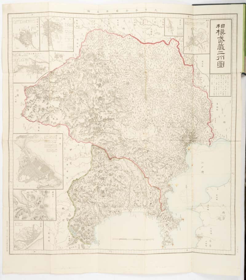
相模武蔵二州図. [Sagami Musashi nishu-zu].
[Map of Sagami and Musashi Provinces].
東京. [Tokyo]. 地理局地誌課. [Chiri-kyoku Chishi-ka]. Meiji 12 [ 1879]. Stock ID #177223 This appealing map from 1879 covers Sagami and Musashi Provinces in the area where western Tokyo, Kanagawa Prefecture and Saitama Prefecture are today. In the fine copper engraved lines topographical features are drawn in detail and provincial boundaries are shown in red. Eight inset maps cover Yokohama where the foreign concession was established, Yokosuka, Odawara and some other cities. Present Tokyo Bay is marked as Edo Bay here. Detailed place names are recorded across the map. This map was the fifth map in the National Map Series. When referring to this item please quote stockid 177223.
Copper engraved folding map with outline handcolour, 70 x 62cm, folds into cloth covers 18 x 13 cm. The scale is approximately 1:216000. Seven inset maps or plans. Occasional spotting, some mending on reverse along folds, a few small holes at folds. A prior owner's chop inside front cover. Very good map in original cloth covers with original Japanese paper title label and an old label with the title written in ink in English laid down. Scarce.
Price: $750.00 AU