![Stock ID #177248 最新欧羅巴現勢図. [Saishin Yōroppa genseizu]. [Most Recent Situation Map of Europe]. YOMIURI SHINBUNSHA HENSHŪKYOKU, 読売新聞社編集局.](https://asiabookroom.cdn.bibliopolis.com/pictures/177248.jpg?width=768&height=1000&fit=bounds&auto=webp&v=1709611282)
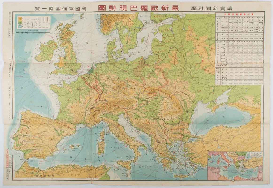
最新欧羅巴現勢図. [Saishin Yōroppa genseizu].
[Most Recent Situation Map of Europe].
東京. [Tokyo]. 読売新聞社. [Yomiuri Shinbunsha]. Showa 14 [ 1939]. Stock ID #177248 This map of Europe was published in October 1939, soon after the German invasion of Poland. The map marks the area of the German invasion with red lines, as well as the Siegfried and the Maginot Lines. Curiously, Hungary is shown as controlling Carpathian Ruthenia, though not Southern Slovakia, as would be expected at this time. When referring to this item please quote stockid 177248.
Colour folding map, 1:6,000,000 scale, 55 x 78cm, small repaired tear on one fold, very good copy.
The inset chart shows a comparison chart of the military power, trading figures, area, and population of Germany, Italy, Britain, the USA, France the Soviet Union and Poland.
An inset map shows the Mediterranean Sea and surrounding region (1:20,000,000 scale).
Price: $300.00 AU