![Stock ID #177936 嘉永改正分見大坂図. [Kaei kaisei bunken Osaka zu]. [Scaled Plan of Osaka. Revised in Kaei Period]. MORIKAWA HOBYAKUDO, 森川宝白堂.](https://asiabookroom.cdn.bibliopolis.com/pictures/177936.jpg?width=768&height=1000&fit=bounds&auto=webp&v=1706170627)
![嘉永改正分見大坂図. [Kaei kaisei bunken Osaka zu]. [Scaled Plan of Osaka. Revised in Kaei Period].](https://asiabookroom.cdn.bibliopolis.com/pictures/177936_2.jpg?auto=webp&v=1706170628)
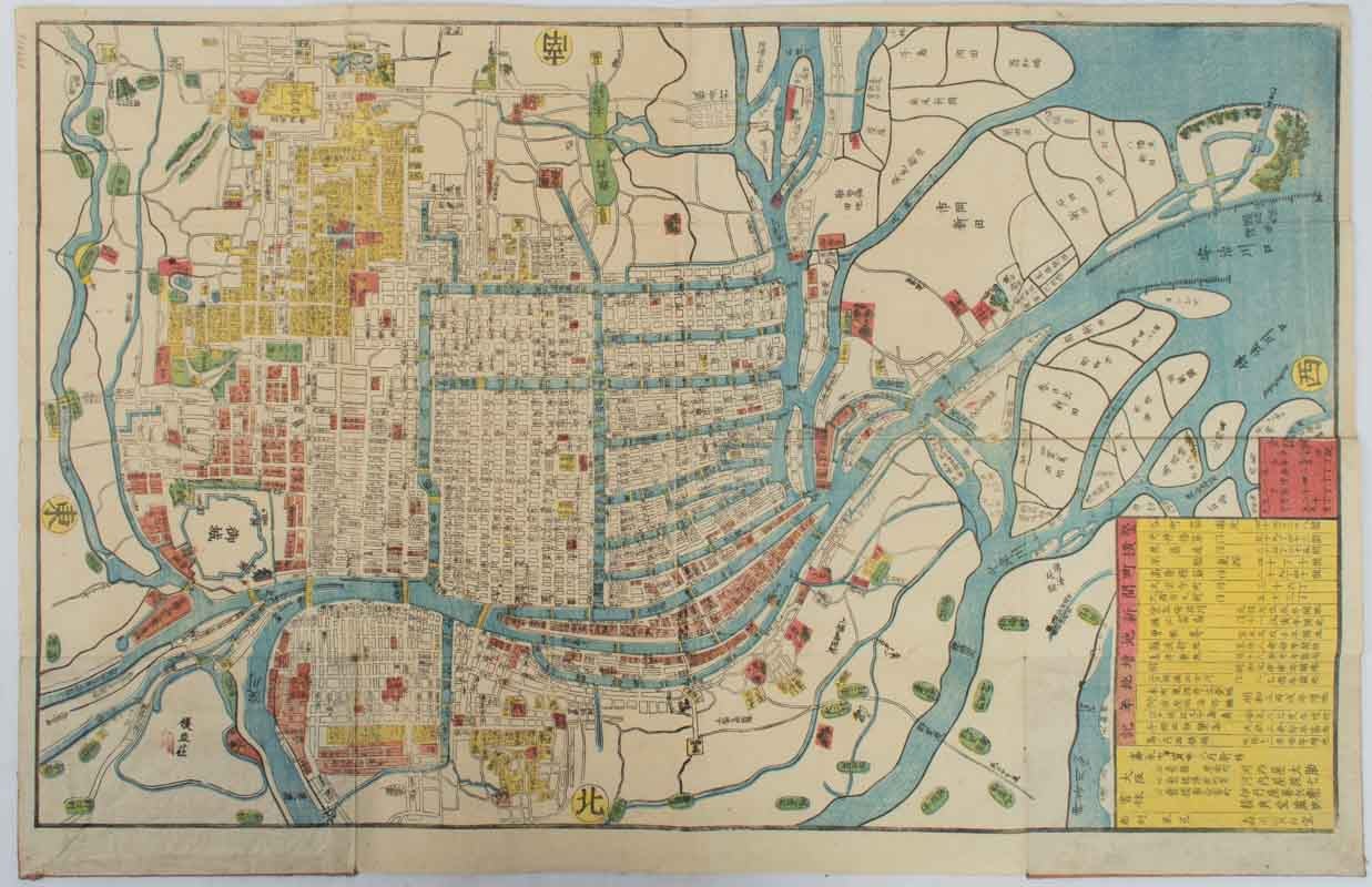
嘉永改正分見大坂図. [Kaei kaisei bunken Osaka zu].
[Scaled Plan of Osaka. Revised in Kaei Period].
大阪. [Osaka]. 河内屋太助. [Kawachiya Tasuke]. Kaei 7 [ 1854]. Stock ID #177936 This wood block map of Osaka from 1854 shows the layout of the city at the end of Edo Period. Main sites and buildings, including temples, shrines and feudal lords' residents, are marked in red and names of streets and bridges are added. Legends include the length of the city's main streets and when newly reclaimed lands were established. Osaka is renowned for its water ways and it is clear in this mid-19th century map, that at that time the rivers and canals were still criss-crossing the city. When referring to this item please quote stockid 177936.
Coloured wood block map, 40.4 x 65.0 cm, folding to 18 x 12cm with the original covers, worn and rubbed but the map is bright and clean, a very good copy.
Price: $350.00 AU