![Stock ID #177937 改正新刻京都市街名所新図. [Kaisei shinkoku Kyoto Shigai Meisho Shinzu]. [Revised and Newly Printed Map of Kyoto City and its Major Sites]. KATAOKA KENZO, 片岡賢三.](https://asiabookroom.cdn.bibliopolis.com/pictures/177937.jpg?width=768&height=1000&fit=bounds&auto=webp&v=1697783570)
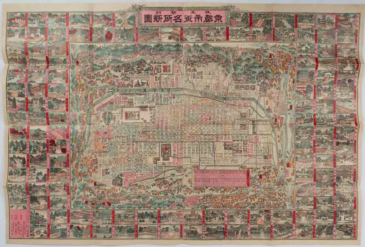
改正新刻京都市街名所新図. [Kaisei shinkoku Kyoto Shigai Meisho Shinzu].
[Revised and Newly Printed Map of Kyoto City and its Major Sites].
京都. [Kyoto]. 風月庄左エ門. [Fugetsu Shozaemon]. Meiji 30 [ 1897]. Stock ID #177937 This beautiful pictorial map of Kyoto from 1897 shows the central city around the Royal Palace and Nijo Castle and the surrounding area. Each city block is coloured and some topographical features and major buildings, including temples and shrines, are illustrated in detail. Over 100 illustrated panels of major sites and buildings surround the map. Each illustration is coloured and titled. A small inset chart shows the distances to major attractions from Sanjo Bridge and Kyoto Railway station. This map shows that Kyoto was a major tourist destination by the end of the 19th century, just as it is in the 21st century. When referring to this item please quote stockid 177937.
Colour map, colour illustrated panels, 53 x 76 cm, folded to 20 x 14cm, some closed tears and small holes at folds have been neatly repaired with archival material on the verso.
Price: $450.00 AU