![Stock ID #178180 大東亜共栄圏及び太平洋要図. [Daitōa Kyōeiken oyobi Taiheiyō yōzu]. [Map of the Greater East Asia Co-prosperity Sphere and the Pacific Ocean]. JŌHŌ-KYOKU, 情報局.](https://asiabookroom.cdn.bibliopolis.com/pictures/178180.jpg?width=768&height=1000&fit=bounds&auto=webp&v=1697784489)
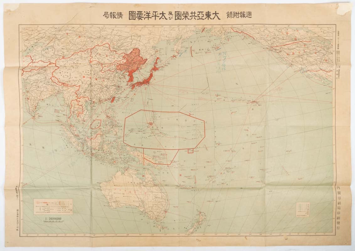
大東亜共栄圏及び太平洋要図. [Daitōa Kyōeiken oyobi Taiheiyō yōzu].
[Map of the Greater East Asia Co-prosperity Sphere and the Pacific Ocean].
東京. [Tokyo]. 内閣印刷局. [Naikaku Insatsu-kyoku]. Showa 16 [ 1941]. Stock ID #178180 This large impressive map was published as a supplement to "Shashin Shuho", a weekly pictorial journal published by the Cabinet Intelligence Department, on 30 April 1941. Titled the "Co-Prosperity Sphere" the map is essentially a detailed propaganda map of East Asia and the Pacific showing areas of Imperial occupation and those of military interest. The map legend includes national borders, the Great Wall of China, transport routes, locations of Japanese diplomatic representation, air, naval and submarine bases, mineral mines, oil wells and radio transmitting stations. When referring to this item please quote stockid 178180.
Large folding coloured map, 55 x 79 cm, legends, outline and shading in red, upper right tear mended, top corners mended with archival paper and closed tears repaired with archival washi, paper age toned and friable but still in good condition.
Price: $350.00 AU