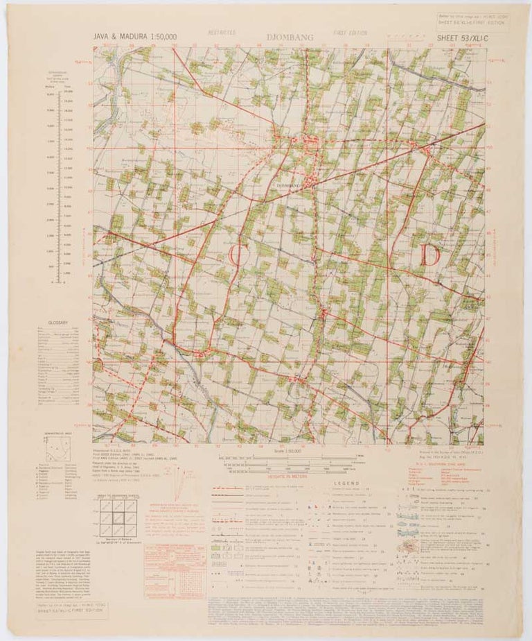
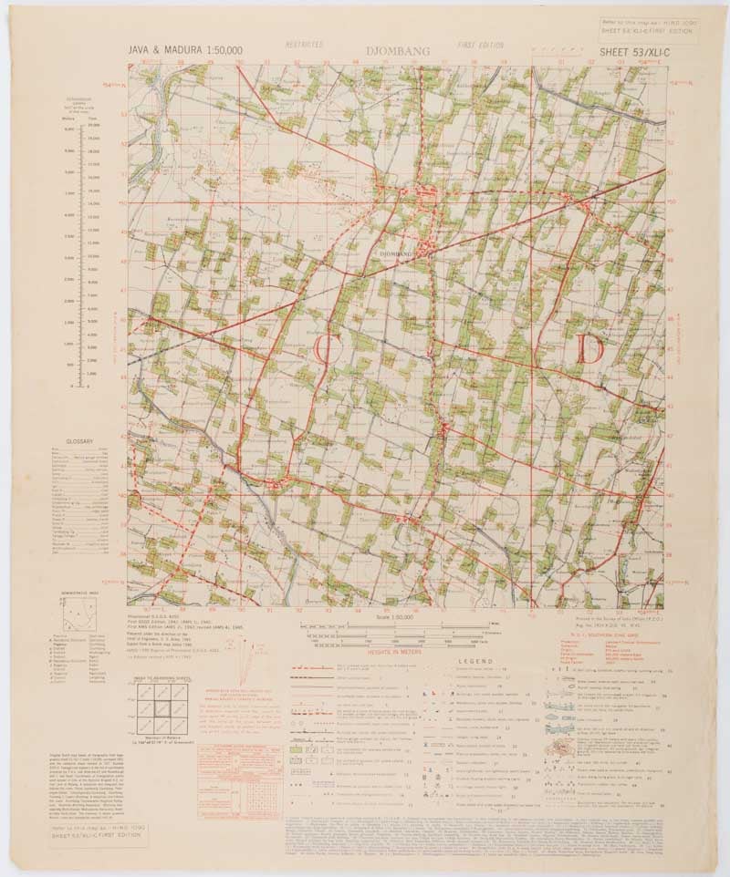
Java & Madura. 1:50,000. Djombang. Sheet 53/XLIC. (HIND 1090).
Washington, D.C. Army Map Service. 1945. First edition - revised (AMS4). Stock ID #200411 Wartime map produced by the US Army Map Service (AMS) who formed in 1942 and were at the forefront of military mapping campaigns during WWII and the post-war years. The very detailed map shows residency and administrative boundaries, transportation, ground and water features, vegetation, cultivation, ruins, religious sites "Graves; Chinese, native," and "Cemetery; heathen, Christian", walls, hedges, populated places, built-up areas and buildings (with those of iron, stone, wood and bamboo differentiated by colour); fishponds, plantations and much more. When referring to this item please quote stockid 200411.
Army survey map printed in colour, 36.7 x 36.7 cm; 58 x 48 cm (sheet), conversion graph, glossary and administrative index to the inner margin; scale, three column legend, index to adjoining sheets and notes re grid references and mean declination to the foot; sheet toned, a very few edge tears, the map in very good condition.
Price: $375.00 AU