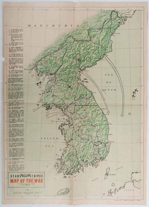
Pacific Stars and Stripes. Map of the War.
Geographic Branch, G-2, GHQ, FEC. March 1952. Folding map printed in green, black and red. Few minor chips at edges, title written in ink on reverse, but overall very good. A map of Korean War zone produced by the US military (geographic section) and pub;ished in the magazine "Stars and..... More

![Stock ID #176323 奈良市街全図. [Nara shigai zenzu]. [Complete Map of Nara City Area]....](https://asiabookroom.cdn.bibliopolis.com/pictures/176323.jpg?width=320&height=427&fit=bounds&auto=webp&v=1699563766)
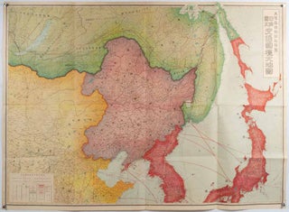
![Stock ID #160524 東部亜細亜圖. 五百万分一. [Tobu Ajiazu. Gohyakumanbunnoichi].[East...](https://asiabookroom.cdn.bibliopolis.com/pictures/160524.jpg?width=320&height=427&fit=bounds&auto=webp&v=1713235705)
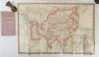
![Stock ID #161936 China. Philips' Travelling Maps [Cover Title]. LINEN BACKED MAP OF CHINA](https://asiabookroom.cdn.bibliopolis.com/pictures/161936.jpg?width=320&height=427&fit=bounds&auto=webp&v=1699558332)
![Stock ID #176324 安東案内. [Antō annai]. Guide to Antung (Andong). MANTETSU ANTŌEKI,...](https://asiabookroom.cdn.bibliopolis.com/pictures/176324.jpg?width=320&height=427&fit=bounds&auto=webp&v=1713235705)
![Stock ID #177791 [江戸時代紀淡海峡海図. Edo-jidai Kitan Kaikyo kaizu]. [Edo Period...](https://asiabookroom.cdn.bibliopolis.com/pictures/177791.jpg?width=320&height=427&fit=bounds&auto=webp&v=1710492331)
![Stock ID #176165 興亜詳密大地図. [Kōa shōmitsu daichizu]. [Detailed Map of...](https://asiabookroom.cdn.bibliopolis.com/pictures/176165.jpg?width=320&height=427&fit=bounds&auto=webp&v=1710492327)
![Stock ID #177994 列国の極東航空施策. [Rekkoku no Kyokutō kōkū shisaku]. [Major...](https://asiabookroom.cdn.bibliopolis.com/pictures/177994.jpg?width=320&height=427&fit=bounds&auto=webp&v=1710492333)
![Stock ID #176771 放送ニュース聴取用地図. [Hōsō nyusu choshuyō chizu]. [Wireless...](https://asiabookroom.cdn.bibliopolis.com/pictures/176771.jpg?width=320&height=427&fit=bounds&auto=webp&v=1699563769)
![Stock ID #180538 海陸御固泰平鑑. [Kairiku okatame taihei kagami]. [Sea and Land...](https://asiabookroom.cdn.bibliopolis.com/pictures/180538.jpg?width=320&height=427&fit=bounds&auto=webp&v=1710493338)