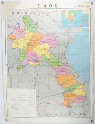
![Stock ID #177779 世界戦下の世界全図. [Sekai senka no sekai zenzu]. [Map of the World...](https://asiabookroom.cdn.bibliopolis.com/pictures/177779.jpg?width=320&height=427&fit=bounds&auto=webp&v=1700105524)
世界戦下の世界全図. [Sekai senka no sekai zenzu]. [Map of the World under the World War].
東京. [Tokyo]. 盛文館. [Seibunkan]. Circa 1942. Colour map, 75 x 110cm, folds to 28 x 19cm. Some light browning, somewhat heavier along a few folds. A good copy. This map, which was most likely published around 1942 or 1943, depicts the world during the global conflict. Japan is positioned in..... More
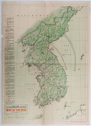
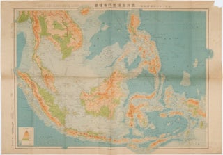
![Stock ID #177247 東亜現勢大地図. [Tōa gensei daichizu]. [Current Situation Map of...](https://asiabookroom.cdn.bibliopolis.com/pictures/177247.jpg?width=320&height=427&fit=bounds&auto=webp&v=1699563769)
![Stock ID #178266 日本南極探検図. [Nihon Nankyoku tanken-zu]. [Illustrated Map of the...](https://asiabookroom.cdn.bibliopolis.com/pictures/178266.jpg?width=320&height=427&fit=bounds&auto=webp&v=1708478206)
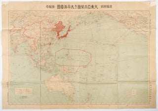
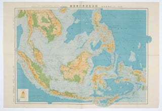
![Stock ID #160543 南方共榮圈要圗. 其の 1. [Nanpo kyoeiken yozu. sono 1]. [Map of...](https://asiabookroom.cdn.bibliopolis.com/pictures/160543.jpg?width=320&height=427&fit=bounds&auto=webp&v=1713235705)
![Stock ID #177219 大阪区分名所新図全. [Osaka kubun meisho shinzu zen]. [Folding Map...](https://asiabookroom.cdn.bibliopolis.com/pictures/177219.jpg?width=320&height=427&fit=bounds&auto=webp&v=1699563768)
![Stock ID #178233 樺太地質概察圖. [Karafuto chishitsu gaisatsuzu]. Preliminary...](https://asiabookroom.cdn.bibliopolis.com/pictures/178233.jpg?width=320&height=427&fit=bounds&auto=webp&v=1708478207)


![Stock ID #176323 奈良市街全図. [Nara shigai zenzu]. [Complete Map of Nara City Area]....](https://asiabookroom.cdn.bibliopolis.com/pictures/176323.jpg?width=320&height=427&fit=bounds&auto=webp&v=1699563766)
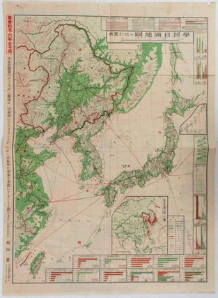
![Stock ID #160524 東部亜細亜圖. 五百万分一. [Tobu Ajiazu. Gohyakumanbunnoichi].[East...](https://asiabookroom.cdn.bibliopolis.com/pictures/160524.jpg?width=320&height=427&fit=bounds&auto=webp&v=1713235705)