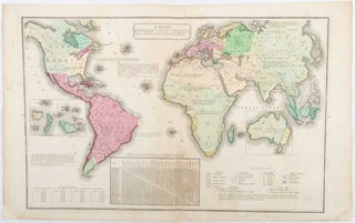
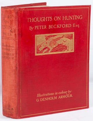
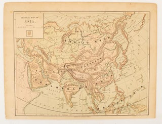
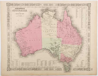
A Chart Exhibiting the Actual and Comparative Size of each Country, Nation, or Kingdom; its Population as a whole and to a Square Mile: Also the different States of Society Forms of Government, Religion, &c.
(Philadelphia). (circa 1835). Handcoloured engraved map, 26.5 x 41.3 cms; 29.6 x 48.3 cms (sheet), central fold, insets of "Oceanica" and "New Holland", central table, some light staining in the image and margins, in good condition. Eurocentrism laid bare. This 19th Century map includes a "State of Society" for each..... More
![Stock ID #176078 Printed Leaf from Super Tertio [Petri Lombardi] Libro Sententiarum. THOMAS C....](https://asiabookroom.cdn.bibliopolis.com/pictures/176078.jpg?width=320&height=427&fit=bounds&auto=webp&v=1692027106)
![Stock ID #177983 [風俗画報合本. Fūzoku Gahō gappon]. [Bound copies of Fūzoku Gahō...](https://asiabookroom.cdn.bibliopolis.com/pictures/177983.jpg?width=320&height=427&fit=bounds&auto=webp&v=1706170632)

![Stock ID #177788 御行幸名前附. [Ongyōkō namae tsuke]. [Emperor's Procession with...](https://asiabookroom.cdn.bibliopolis.com/pictures/177788.jpg?width=320&height=427&fit=bounds&auto=webp&v=1710492331)