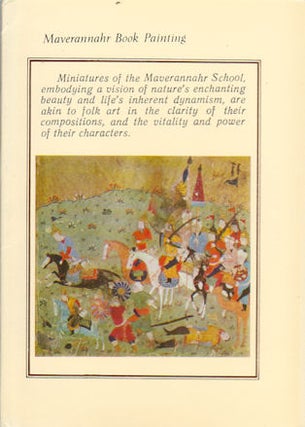
Russia in Asia, Eastern Siberia.
Double page map with outline printed colour, central fold, sheet measures 36 x 43cm. From Letts's Popular Atlas. (When referring to this item please quote stockid 88958). More
Rainer Ottens. 1723. A most attractive map with early outline hand colour, vertical fold, barely visible diagonal crease upper half of map, few very pale small brown spots, otherwise a clean and bright image. Numbering in red pencil, few annotations in pencil and light number stamp on reverse however not..... More
September 22,1888. 2 individual leaves from the 19th century newspaper, The Graphic, showing a total of small black and white wood engravings illustrating various aspects of construction of the railway. Sheets measure 40.5 x 30.5cm. (When referring to this item please quote stockid 159024). More
(circa1657). Hand coloured map of Central Asia. Latin text on reverse. Image measures 38.2 x 39.9cm. Matted. Little creased at fold, some inoffensive time toning upper edge. A very handsome map. This attractive map shows part of Central Asia. From the Caspian Sea on the left of the map through..... More
(circa1745). Examined and Rectified by Mr. Bolton. Black and white engraved map. Sheet measures 41.2 x 46.1cm. Some light browning particularly along vertical fold. Good copy. (When referring to this item please quote stockid 159702). More