![Stock ID #172590 満洲鉄道図. [Manshu tetsudo zu]. [Railway Map of Manchuria]. KIYOSHI KIKUCHI, 菊池清編輯.](https://asiabookroom.cdn.bibliopolis.com/pictures/172590.jpg?width=768&height=1000&fit=bounds&auto=webp&v=1697774532)
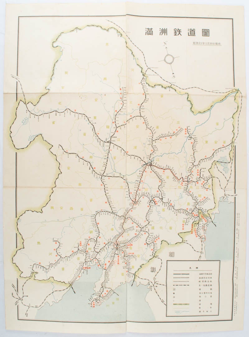
満洲鉄道図. [Manshu tetsudo zu].
[Railway Map of Manchuria].
奉天. [Mukuden]. 満鉄鉄道総局. [Mantetsu Tetsudo Sokyoku]. 昭和 15 [ 1940]. Stock ID #172590 Map showing the comprehensive railway network in Manchuria with names of all the stations. It includes the lines run by the South Manchurian Railway Company, their temporary industrial lines, light rail as well as the lines run by other Russian and Chinese companies. By 1940 the network had expanded so much that it included almost the whole of Manchuria. When referring to this item please quote stockid 172590.
Colour folded map, seven small very holes not affecting the printed image otherwise good. 53 x 38.5cm,
Price: $300.00 AU
See all items in
All Galleries,
Ephemera and Maps
See all items by KIYOSHI KIKUCHI, 菊池清編輯