![Stock ID #177219 大阪区分名所新図全. [Osaka kubun meisho shinzu zen]. [Folding Map of Osaka - Wards and Major Sites in Osaka, Complete Version]. TATSUNOSUKE KABAI, 樺井達之輔編輯.](https://asiabookroom.cdn.bibliopolis.com/pictures/177219.jpg?width=768&height=1000&fit=bounds&auto=webp&v=1699563768)
![大阪区分名所新図全. [Osaka kubun meisho shinzu zen]. [Folding Map of Osaka - Wards and Major Sites in Osaka, Complete Version].](https://asiabookroom.cdn.bibliopolis.com/pictures/177219_2.jpg?auto=webp&v=1699563767)
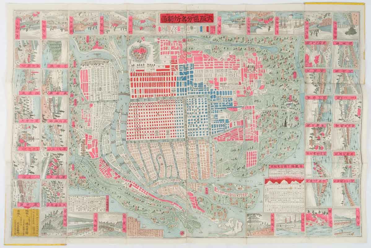
大阪区分名所新図全. [Osaka kubun meisho shinzu zen].
[Folding Map of Osaka - Wards and Major Sites in Osaka, Complete Version].
京都. [Kyoto]. 風月庄衛門. [Fugetu Shoemon]. Meiji 20 [ 1887]. Stock ID #177219 This charming pictorial map of Osaka from 1887 features the central 4 wards of Osaka City (East, West, North and South Wards in different colours) and the surrounding area with place names and some landmarks. 41 small illustrated panels of major sites surround the map. Distances from Korai Bridge as the city's central point are recorded in a chart. Another chart lists famous attractions of Osaka city. Legend includes schools, temples, shrines, and railway lines. When referring to this item please quote stockid 177219.
Handcoloured copper engraved pictorial folding map, 47.5 x 71cm, 41colour illustrations border the map, distance and site charts. Folds into card covers measuring 16.2 x 17.2cm. An attractive map.
Osaka is renowned for its rivers and canals and used to be known as the capital of waterways before many were filled in to build roads and highways. This map shows Osaka at a time when the numerous rivers and canals were still crisscrossing the city. Osaka Castle was used as the Army Headquarters during the Meiji era, and it, and other major government buildings, stations, bridges and temples are beautifully illustrated in the images that surround the map.
Price: $450.00 AU