![Stock ID #177474 非常時国防一覧東亜太平洋地図. [Hijōji kokubō ichiran Tōa Taiheiyō chizu]. [Map of East Asia and the Pacific Area for Emergency National Defence]. KINGU HENSHŪKYOKU, キング編集局.](https://asiabookroom.cdn.bibliopolis.com/pictures/177474.jpg?width=768&height=1000&fit=bounds&auto=webp&v=1706685395)
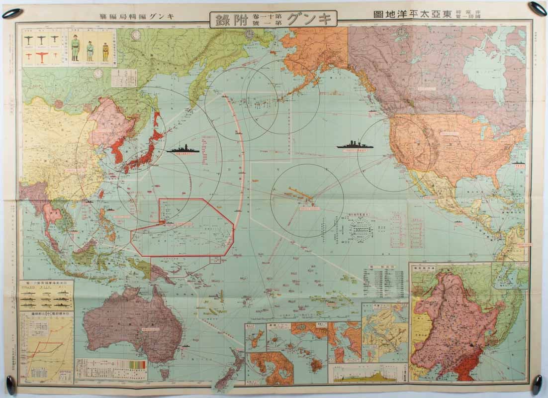
非常時国防一覧東亜太平洋地図. [Hijōji kokubō ichiran Tōa Taiheiyō chizu].
[Map of East Asia and the Pacific Area for Emergency National Defence].
東京. [Tokyo]. 大日本雄弁会講談社. [Dai Nihon Yūbenkai Kōdansha]. Showa 10 [ 1935]. Stock ID #177474 A huge map showing an early indication of Japan's sense of urgency in East Asia and the Pacific region. Inset maps of Guam, Hawaii, Pearl Harbor, San Francisco, Manila, the Panama Canal and cities, Manchuria and Vladivostok. There is information on the military capabilities and number of troops of the USA, Japan and the USSR. It also features trading figures between Japan and foreign countries. This map shows the military and economic relations of Japan with other major countries and regions in the period around 1935, just prior to World War II. This was issued as a supplement by the Japanese popular magazine, Kingu (King) for January 1935. When referring to this item please quote stockid 177474.
Colour map, 79 x 110 cm, folding as issued. Short separations with tiny paper loss at several fold intersections, now secured with archival washi, light toning to outside panels (not affecting the map).
The map is titled, "Emergency national defence" because various incidents which took place in 1934. The most significant one was Japan's withdrawal from the Washington Naval Treaty, which had restricted the naval powers among the major nations. After the withdrawal, Japan started to become more isolated in its foreign policy. The map shows comparative naval powers between Japan, and the USA. Inset maps of Guam, Pearl Harbor and other military ports also indicate the level of threat Japanese people felt around that time.
Price: $450.00 AU