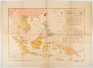
外南洋二於ける邦人拓殖事業状況圖. [Sotonanyō ni okeru hōjin takushoku jigyō jyōkyōzu]. [Map and Charts on the Japanese Economic Activities in the Outer South Seas].
[Japan]. 拓務省拓南局. [Takumushō Takunankyoku]. Circa [ 1950?]. Colour folding map, 37.5 x 52.7cm, some browning, few holes along folds. Published after the Second World War, this colour map documents Japanese economic activities in Southeast Asia around 1939. Three charts at the upper right show Japanese migrant numbers, major agricultural produce..... More
