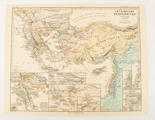
Oströmisches Reich 1096-1204
Gotha: Justus Perthes, 1876. Map with original colour and outline hand-colour, 32.2 x 40 cm, text in German, four inset maps, central fold, slight marginal toning, and spotting on the verso, but in very good condition. A most handsome and highly detailed map detailing the Eastern provinces of the Byzantine/Roman..... More